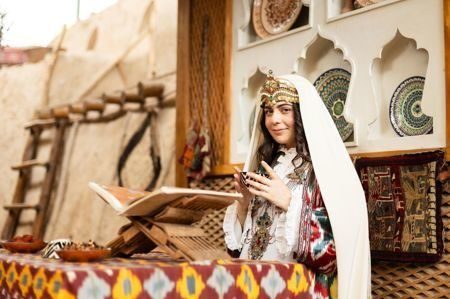
The Savitsky State Museum of Art in Nukus, the capital of Karakalpakstan (Uzbekistan), is often referred to as the “Louvre of the Desert.” This extraordinary museum houses one of the world’s largest collections of Russian avant-garde art, along with an impressive array of Uzbek, Karakalpak, and Soviet-era works.
History of the Savitsky Museum
Founded in 1966, the State Museum of Arts of the Republic of Karakalpakstan named after I.V. Savitsky was the life’s work of Igor Vitalievich Savitsky — a painter, archaeologist, and passionate collector. During the Soviet era, many of the artworks he preserved were considered “unacceptable” and were often destroyed or banned.
Thanks to his tireless dedication, the museum now features works by artists such as:
-
Alexander Volkov
-
Robert Falk
-
Usto Mumin
-
Viktor Ufimtsev
-
Lyudmila Petrova
and many others once forgotten by mainstream art history.
Why Is It Called the “Louvre of the Desert”?
Located in the remote Kyzylkum Desert, far from the typical tourist routes, the museum has gained international acclaim. Leading global media like The Guardian, The New York Times, and Le Monde have featured it as one of the most remarkable and unexpected museums in the world.
🔹 Russian Avant-Garde Collection
The museum holds over 20,000 works of painting, graphics, and sculpture, making it the second-largest collection of Russian avant-garde art in the world, after the Russian Museum in St. Petersburg.
🔹 Traditional and Modern Uzbek Art
The collection showcases the rich artistic traditions of Uzbekistan and Central Asia, including textiles, carpets, ceramics, jewelry, musical instruments, and folk costumes.
🔹 Archaeology and Ethnography of Karakalpakstan
Another section is devoted to the archaeological and ethnographic heritage of the Khorezm region, with artifacts uncovered by Savitsky himself during expeditions across the deserts of Uzbekistan.

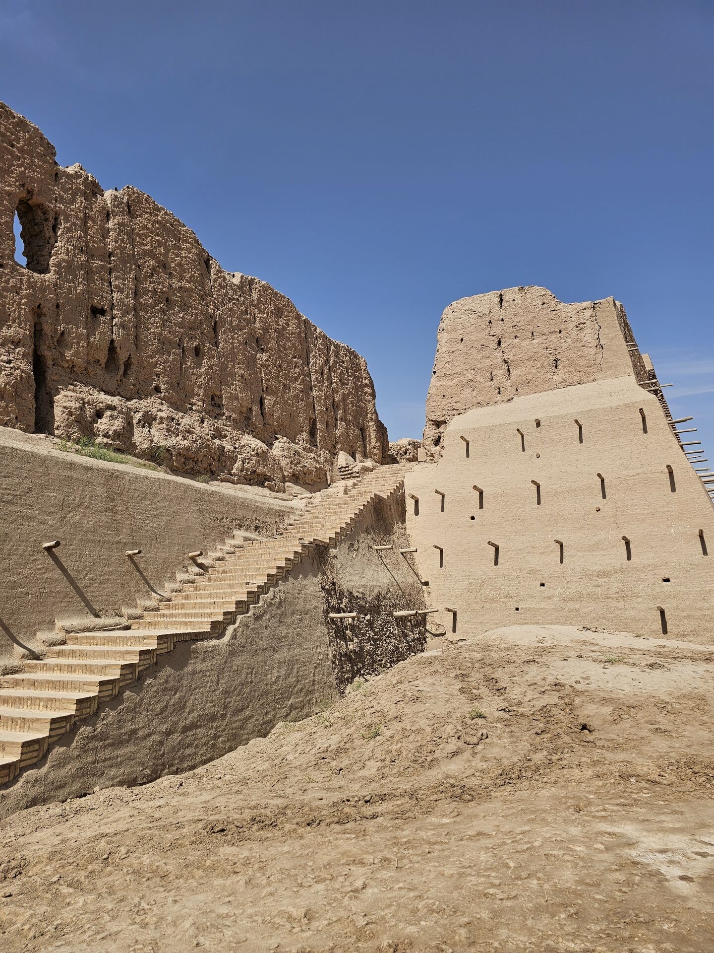
Toprak-Kala (Uzbek: Tuproq qalʼa) is an ancient archaeological site covering an area of more than 120 hectares, located in the territory of the Republic of Uzbekistan. The name "Toprak-Kala" translates as “Earth-Covered Fortress.”
It is believed that Toprak-Kala was the ancient capital of Khorezm during the rule of the Afrighid dynasty. This dynasty established its authority based on Toprak-Kala, originally located on the right bank of the Amu Darya River. Cultural evidence shows links to the Kushan Empire, while the worldview of its inhabitants reflects influences of Hinduism, Buddhism, Zoroastrianism, and ancient Greek religious ideas. Ancient Khorezmian script has been discovered at the site.
Along the right bank of the Amu Darya, in addition to Toprak-Kala, a series of other luxurious fortresses were constructed — including Kanka-Kala, Djanbas-Kala, Bazar-Kala, Kırkkız, Kurgashin-Kala, and Ayaz-Kala. These fortresses were built after the development of irrigation systems and placed close to one another for defense. According to scholars, this concentration of fortifications reflects the real power of Khorezm during that period.
From 1937 to 1991, Toprak-Kala was the focus of a unique, long-running archaeological and ethnographic expedition in Khorezm, launched under the leadership of Sergey Tolstov. From 1945 to 1950, archaeological excavations were conducted on the Great Khorezmian Palace.
Excavations revealed the remains of a palace with 150 halls and rooms, richly decorated with monumental paintings and sculptures. The paintings discovered in Toprak-Kala are stylistically similar to those found in Ajanta. These artworks were located not only in the royal palace rooms and halls but also in ordinary residential houses.
The height of the palace reached up to 40 meters. The entire Toprak-Kala archaeological complex included several palaces as well as a residential city with housing blocks.
At the heart of the palace was the Throne Hall, where ceremonial events were held. The palace walls were festively painted and decorated. The main sanctuary was the Hall of Dancing Masks, also called the Temple of Anahita, whose walls bore 16 bas-relief panels depicting dancing men and women. Another notable area is the Hall of Warriors, with numerous images of kings standing with ram’s horns on mountaintops, where fires were lit on New Year’s Day. One sculpture portrays a king wearing a crown with an eagle perched on his arm. There was also a Deer Hall, its walls adorned with beautiful paintings of deer and griffins, as well as other halls — such as the Hall of Kings, the Hall of Victory, and others.
A palace archive of the Khorezmian rulers was discovered during the excavations. It contained documents written on leather (inventories or registers of issued or received items), on wooden tablets and sticks (lists of male names — both free and domestic slaves belonging to large households), as well as economic records and tags. All were written in black ink in a script that can be classified as early Khorezmian cursive.
In the early 4th century CE, the city walls were rebuilt, and the palace was transformed into a citadel. By the 5th century, Toprak-Kala briefly became a settlement for common people before eventually being abandoned.
Kyzyl-Kala
The Kyzyl-Kala fortress is located in the territory of ancient Khorezm (modern-day Karakalpakstan), in close proximity to the ancient city-site of Toprak-Kala. According to some sources, Kyzyl-Kala was part of Toprak-Kala’s defensive system and served as an auxiliary stronghold.
Kyzyl-Kala is a monument representing the final stage in the architectural history of classical Khorezm and can be considered a prototype of the massive, fluted-column castles of the Afrighid period. The site was discovered during the Khorezm Archaeological Expedition led by Sergey Tolstov in 1938, and all major research was conducted by members of this expedition.
The fortress is relatively small and nearly square in shape. Excavations of the foundations and remaining structures revealed that it was surrounded by a double defensive wall, with watchtowers positioned at each corner. A main street ran through the center of the settlement, ending at a fire temple where Zoroastrian priests performed their rituals. The residential area was divided by this street into several sections, each containing rooms where families lived.
Kyzyl-Kala is a unique architectural monument from the Kushan-Afrighid period of ancient Khorezm’s history. It stands alone on the plain, like a sentinel guarding the jewel of ancient Khorezm — the fortress of Toprak-Kala. According to legend, Toprak-Kala and Kyzyl-Kala are connected by an ancient underground passage. This is plausible, as Kyzyl-Kala had a clear defensive role. The fortress remained in use until the Mongol invasion under Genghis Khan and was part of the defensive system of the Khwarazmian state.
Ayaz-Kala

Ayaz-Kala consists of the remains of fortress structures from the period of Kushan culture (3rd–2nd centuries BCE), located about 200 km from the Aral Sea, on the right bank of the Amu Darya River, in present-day Karakalpakstan. The site was first studied in 1939–1940 by the Khorezm Archaeological Expedition led by Sergey Tolstov.
Among a large group of settlements, three are particularly notable. The first is the fortress Ayaz-Kala-3, surrounded by massive walls and featuring minarets and labyrinth-like passages. Within the fortress are the remains of a spacious palace. To the northwest lies Ayaz-Kala-2, built during the Kushan period and later expanded in the 5th–7th centuries CE. Ayaz-Kala-1 is situated on the elevated plateau of Ayaz-Kala, near Lake Ayazkol, and is well preserved. It has been established that Ayaz-Kala-1 served as a military outpost guarding part of the Kushan Empire’s frontier. Excavations have uncovered iron daggers, knives, spear and arrowheads, as well as bronze and gold artifacts.
Ayaz-Kala in Khorezm (Karakalpakstan) consists of two ruined citadels, built from adobe bricks on an elevated site. The surrounding area is the Kyzylkum Desert, which stretches all the way to the Aral Sea. Other citadels scattered across the region were built to defend against nomadic tribes that inhabited this area, which was irrigated by canals diverted from the Amu Darya. The oldest citadels in the region, such as this one, date back to the 4th century BCE. In ancient times, this land was inhabited by nomadic Massagetae tribes, also known as Scythians.